User-centred design
Unlike most consumer facing applications which have very specific target groups, the audience for Prepare Wellington needs to be as inclusive as possible, therefore, it is necessary to use role-based user-centred design.
Even as the population matures and ‘digital natives’ become the majority within the community, WREMO will still need to produce information across various media to ensure as many people as possible remain within reach.
5.1 User interviews and workshops
To initiate the design phase and build empathy with our users, interviews helped to deliver an understanding of how people anticipate and prepare for a disaster, and to discover what plans they may have made for themselves and their family or household. The following exercises help to provide a basis for establishing a user-centred design practice for WREMO. The interviews focussed on a scenario involving a medium to high magnitude earthquake occurring in Wellington City.
All of our interviewees are permanent Wellington residents. From these individuals, the experiences of two participants (both male, 52 and 45 years old) highlighted different ends of our sample spectrum. While both had family, the duration of time spent living in Wellington meant their understanding of a potential situation, and their level of emergency preparedness were markedly different.
Interview transcript discussing the interviewees’ possible response scenario and knowledge of what they might do in a significant seismic event
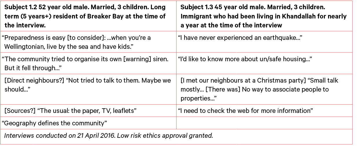
Interview transcript discussing the interviewees’ possible response scenario and knowledge of what they might do in a significant seismic event
These two individuals are very similar demographically, yet confront different geographic challenges in the same city (tsunami zone vs. landslip risk). This diversity of risk scenarios, preparedness levels and community cohesion underlines that while Prepare Wellington can integrate the pre-existing information that crisis maps have displayed to date (what is happening and where), it should also do something new: present the social relations and diversity in geography that is represented by the combination of hazard maps and the location of people and community resources.