Project background
Wellington Region Emergency Management Office (WREMO) is a semiautonomous organisation that coordinates Civil Defence and Emergency Management services on behalf of the nine councils in the Wellington region.
As an organisation, they have been at the forefront of using social media as a civil defence communication tool. WREMO’s Facebook following is the largest for any civil defence/emergency management group in the country.
With an increase in the use of crisis maps during disaster response situations, WREMO instigated this project to consider how crisis maps could be used post-emergency, but also in an everyday context in order to ‘socialise’ the platform to allow for immediate deployment as an emergency response and management tool.
Massey University has expertise in the fields of emergency management (through the Joint Centre for Disaster Research) and within visual communication, user experience and interface design (through the School of Design). Massey design researchers were engaged to consider the feasibility of, and inform directions for, a potential crisis mapping tool.
This work builds on two years of exhaustive work by WREMO staff, particularly Lisa McLaren and Jason Paul. Initially WREMO posited a hub for events as a conduit for socialising the tool, and a map-based repository for information collected through community planning processes.
This project explores and evolves WREMO’s original concept via humancentred design principles. No predetermined platform or technological response has been supposed; needs and opportunities were identified through user and stakeholder interviews, surveys, and testing. A key value in this approach is that the solution should be technologically agnostic and as free from commercial pressure as possible.
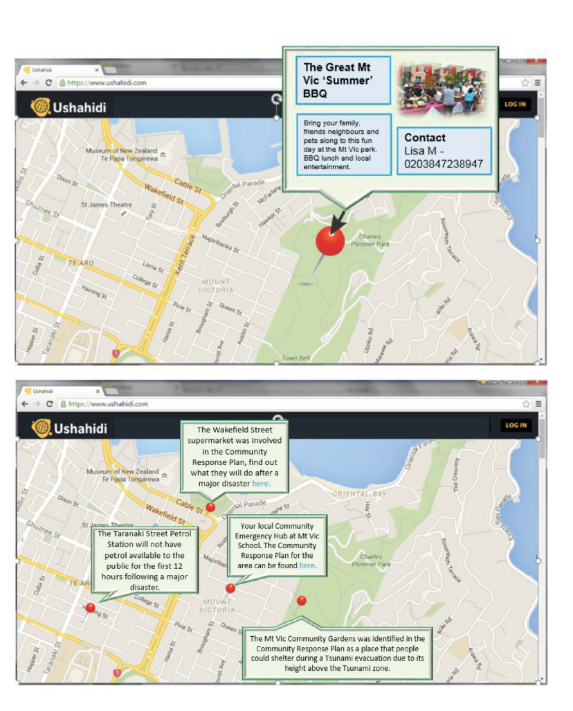
Visual mockups by Lisa McLaren (WREMO) showing ways to display event information, and information from Community Planning Processes